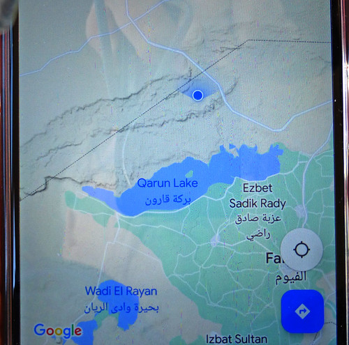
Suggest a ride along the North Shore to us, and like most Minnesotans, we are ready to go! A north shore drive here in Egypt takes the visitor not to waterfalls and beaches along Lake Superior but out into the Fayoum Depression and to Lake Qaroun about 30 miles southwest of Cairo.


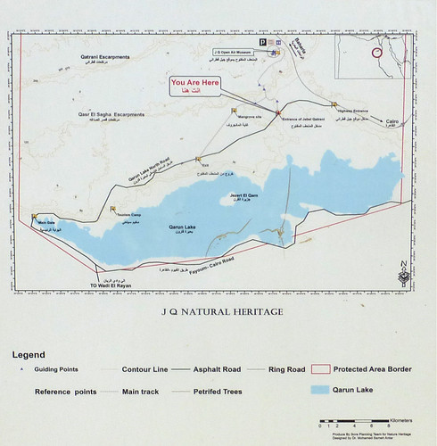
We have visited the Fayoum area several times in the past. (click on the Fayoum tag in the list on the left side of this post to see them) But we have never visited the sights on the north side of the lake. Lake Qaroun forms the boundary between the flat lush agricultural land of the area and the desert and hilly regions to the north.
I had written in a previous post that the Fayoum area didn't seem very tourist-friendly, but the local "chamber of commerce" now seems to be making an effort to publicize a number of interesting geological and archeological sites on the north side of the lake. See, for example, Explore Fayoum and Three Fayoum Itineraries at Barefoot in Egypt.
As usual, we defered to our good friend, Rashid of RashidTourEgypt for arrangements. He found two excellent drivers for us, Mohammed, who provided comfortable transportation to the Fayoum area and Mustafa, who handled the 4-wheel driving through the desert area.
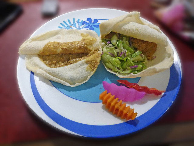
We departed from our apartment at 7:00 a.m. following a tasty Egyptian breakfast of foul and fallafel sandwiches that Rashid picked up at a local restaurant.
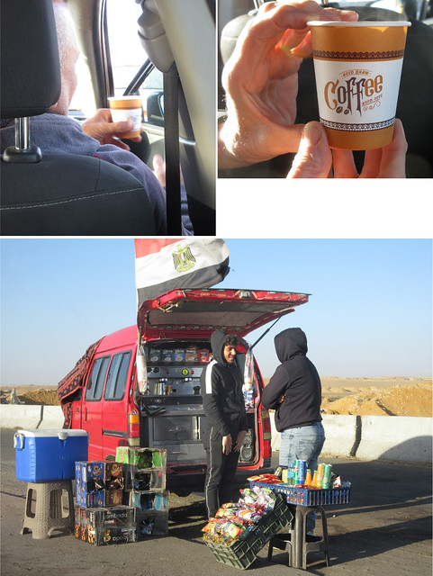
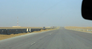
As we left the metro area, Mohammed stopped at one of the many food trucks along the side of the road to pick up a cup of hot coffee for us.
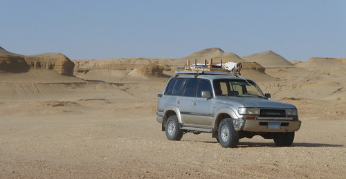
We soon crossed into the Fayoum Governate and turned off on the new outermost ring road from Dashour. We changed vehicles, moving into Mustafa's 4-wheel drive Land Cruiser for the ride through this desert terrain.
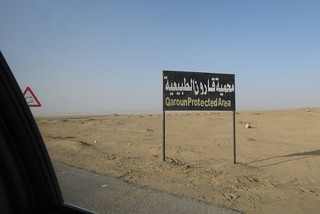
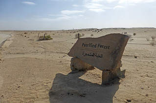
Traffic was light as we approached the entrance to the Jebel Qatrani Open Air Museum which is located inside a Petrified Forest area in the Qaroun protected area.
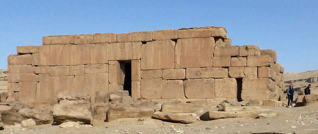
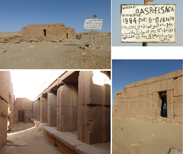
Our first stop was a surprise. As we headed up the hill, we came to a small temple. This is the Qasr El Sagha, or Golden Temple. Believed to be built sometime during ancient Egypt's Middle Kingdom, around 2000 B.C., it was never completed. Short story can be found here. Fifty-four page version is here. The key thing to note is that it was constructed with jigsaw-puzzle-like blocks fitted together with no mortar. Interestingly, the hand-lettered sign in Arabic appears to present a different story, even as to who discovered the ruins. Another blogger has posted numerous photos and discussed their visit here.
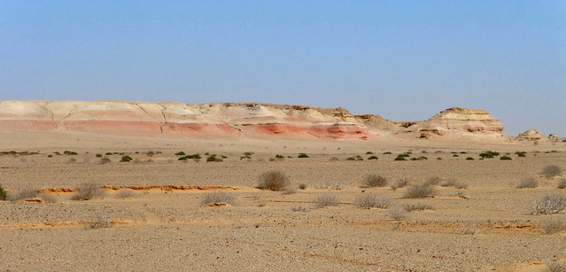
Continuing to the top of the hill, we gained perhaps a couple hundred feet of altitude and found ourselves with a nice view of the rugged territory we had come through. In the distance, Lake Qaroun was barely visible on the horizon and in front of it were some shallow temporary ponds formed by a rare and heavy rain in the previous week.
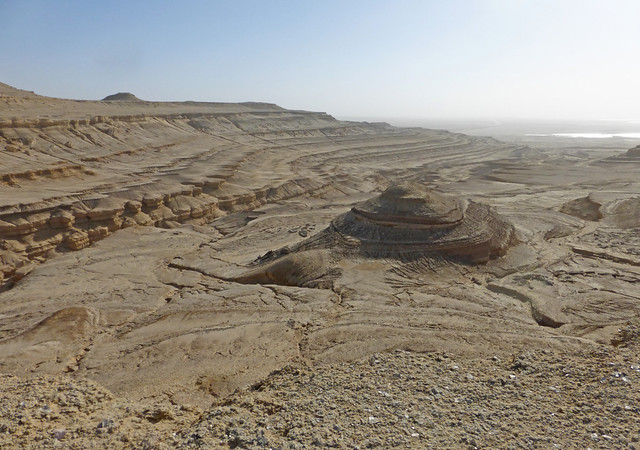
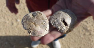
The flat ground that we were standing on was no ordinary sand or soil. It was covered with countless clam or oyster shells left from eons ago when this entire area was under water.

Once we had reached the high ground, it only took a few more minutes to arrive at the petrified forest and open-air museum.
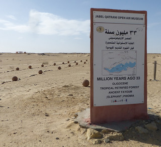

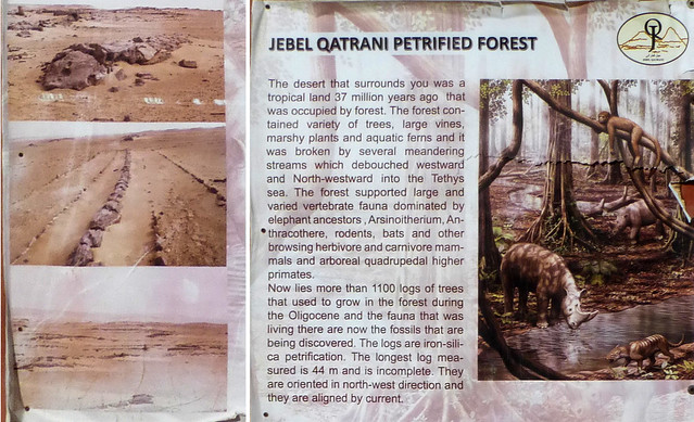
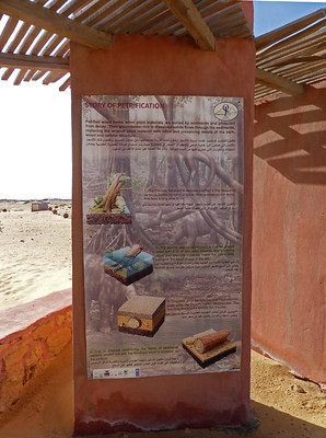
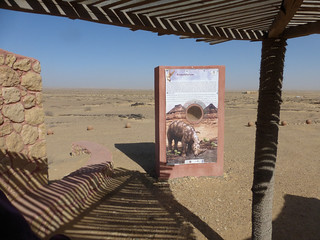
The fossil exhibits are displayed along a walking path of about two miles. There is excellent signage with explanations of the species.
While the temperature was likely a relatively balmy (by Minnesota standards for February) upper fifties or maybe sixty degrees, there was a steady twenty MPH wind blowing which made the several exhibit shelters very welcome places to pause.

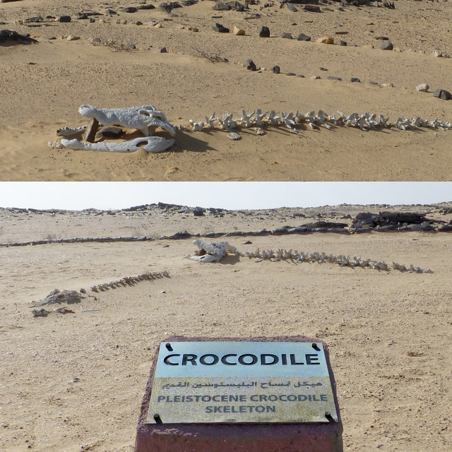
Ancient Egypt is well known for crocodiles, even having a prominent deity, Sobek, take on the form. Fayum was a center for Sobek worship in the 200-300 B.C. era. There is an excellent skeleton on display here.
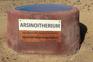
Some of the animal names were unfamiliar to us, like this shoulder bone of an Arsinoitherium. The beast is apparently named for Queen Arsinoe. At six feet tall at the shoulder, this was quite a beast.

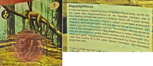
It's hard to visualize the monkeys swinging through the jungle in this spot but I guess 30 million years of climate change makes quite a difference.
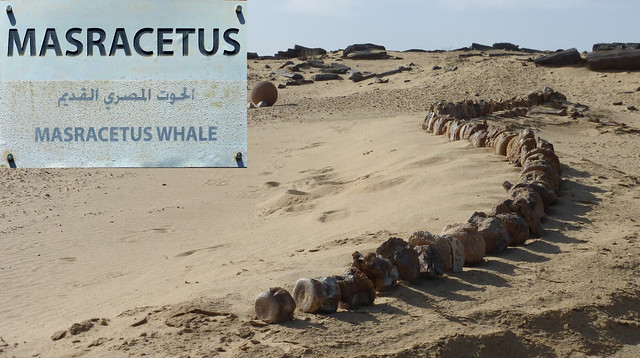
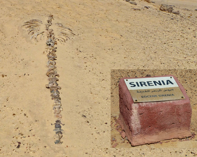
The Sirenia (sea cow) is somehow my favorite species from the area.
When we returned to the 4x4, I took out my phone to mark our position on the camera. I noticed that Google presented us with a good picture of the two escarpments above the lake. We were on top of the first shelf as we drove on to our next stop.
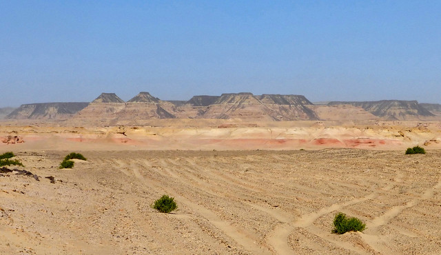
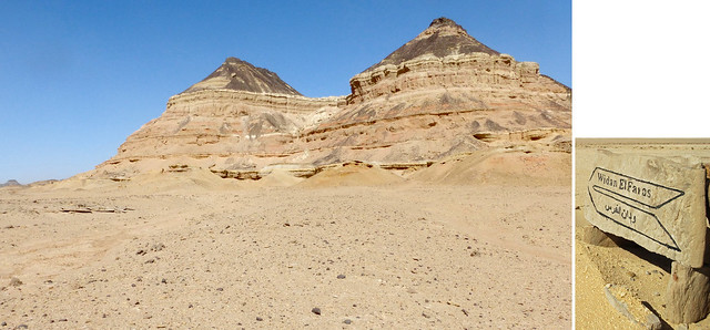
At this point, we were driving parallel to the world's oldest paved road, the Widan El-Faras, built some 4500 years ago to transport basalt blocks from their quarry about seven miles down to the lake which connected to the Nile at the time.
Only remnants of the road remain, many of them pieces of petrified wood.

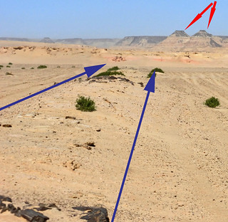
The blue arrows show the road leading up to the twin peaks that mark the edge of the quarry and the area of volcanic activity that is the source of the basalt. Depending on the source that you consult, those two peaks are Widan El-Faras, the "ears of the donkey." Some sources claim Widan El-Faras is either the Basalt road or the name of the quarry. And some claim it is "ears of the mare," not donkey. We are sticking with donkey ears and applying it to the hills.
After exploring the donkey ears, the volcanic area and quarry area it was time to head for lunch.


No comments:
Post a Comment