After our visit to the basalt quarry area at the twin peaks of Widan El-Faras, Mustafa began looking for a nice lunch site. He chose a spot beneath this stone overhang to set up our table and start the grill. The fabric windbreak gave us nice relief from the steady chill wind.

Besides being an excellent driver, Mustafa is a very good barbecue chef.


With a little prep help from his wife the night before, Mustafa soon had a typical salad, potatoes and rice ready to add to the table as the chicken came off the grill.


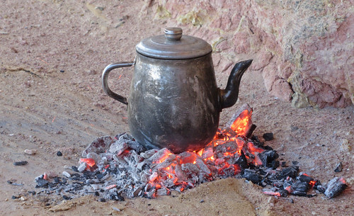
After lunch we had a double shot of warm tea before heading on to our next stop.

When we had finished the tea and packed up we drove farther west along the top of the first escarpment taking in the rugged scenery.


In many spots, the sagebrush-like vegetation had sprouted bright green color. This had happened in the past two weeks since the heavy rainfall, according to Mustafa, who had never seen it like this before. We even noticed new plant growth emerging from the Basalt Road.

Along the route, Mustafa paused to dig holes in the dull-looking sand beside our route. Barely beneath the surface, he showed us the bright red and yellow sand that makes up these hillsides.

There are multiple collections of unusual shaped large stones along the western half of the north shore. This collection of flat-topped plugs is one.


Another collection of stones are these "watermelons".


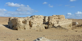
In between the two sets of unusual stones, we came to the ancient ruins of Dimeh al-Siba, "Dimeh of the Lions." Also known by its ancient name, Soknopaiou Nesos, or "Island of Soknopaios," it was the departure point for caravans transporting goods shipped across the then much larger Lake Qaroun and on to the Mediterranean and Rome during the Ptolemaic times around 200 B.C. There is an interesting description of the area here at TourEgypt.
These ruins and the site on the shore of the lake inspired the setting for Soknopaiou Nesos in the computer game, Assassins Creed. You can take a half-hour walk through the "reconstructed" city in a YouTube video posted here. That video shows the water lapping at the shoreline of the city which is now two miles away from the lake. The TourEgypt page linked above explains: "...it was Ptolemy who reduced the size of the lake to provide land for the settlement of retired Macedonian soldiers and their families."
There is some current archeological work taking place here. A sign marks the presence of a team from the University of Salerno which is also mentioned in the Wikipedia article about the historic archeological activity.


We explored the current ruins, taking pictures of a few of the innumerable pot shards.


After departing the ancient city ruins, we found there was one more view of the lake from atop the escarpment near an unusual rock formation.


We descended to lake level in the area where Flamingos are frequently gathered (see our bird-watching post from 2020) but saw only a few other waterfowl this late afternoon.

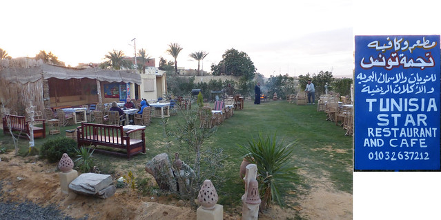
Swinging around onto the south side of the lake, we pulled into this restaurant at the small town of Tunis where we were met by Mohammad, our morning driver, who would take us back to Cairo as dusk settled over the scene. We had another glass of tea before hitting the road. It was about an hour and a half drive back into the city.


No comments:
Post a Comment