Background
Our major outing for the winter in Egypt was a trip to Siwa Oasis, located about three hundred miles to the west of Cairo, just about 30 miles from the Libyan border.

Siwa has been an exotic travel destination from ancient times. Alexander the Great visited around 300 B.C. The 180 miles of blacktop road extending south from the Mediterranean Sea was constructed just about 40 years ago. Prior to that, travelers could expect to go by camel or perhaps via some military vehicle.
Owing to its isolation and plentiful water supply, the population have preserved their own culture and language through the years and have offered great attraction to anthropologists, traders and military expeditions.
Long closed to outsiders without special military permission, Siwa has become a relatively popular destination in recent years. Linda was fortunate to have seen it in the early 1990s shortly after the paved route was opened and there was but a single hotel in the oasis.
Today, there are a growing number of hotels, B&Bs and even enough restaurants to populate a "top ten" list.
Although a second visit to Siwa has been on Linda's "to-do-in Egypt list" for many years, it only attracted my attention after our visit to the World War II memorials back in 2018. (See several of our posts here.)
For anyone with an interest in the WWII desert war, I recommend these two books:
The Desert War by Alan Moorehead - a complete history in 877 pages by the war correspondent who was there.
The Long Range Desert Group by Gavin Mortimer - a well researched book about an intrepid band of volunteers who successfully harassed the Axis powers in North Africa from their bases in Cairo, Siwa and other oases.
Both are available in electronic form at modest price.
Geography and Climate
Siwa Oasis occupies a large area, spread out some 50 miles from east to west and almost 20 miles wide. It lies an average of 60 feet below sea level and about 150 miles south of the Mediterranean Sea. It is strategically located just north of the area of Sahara sands titled "The Great Sand Sea" by early geographers and ten miles west of the vast Qattara Depression generally found to be impassable by vehicles. This depression lies nearly two hundred feet below sea level bounded on the north by a steep escarpment.

It was this combination of circumstances that guaranteed that any military force moving across the continent toward Cairo or Alexandria would be forced through the narrow space at El Alamein and early warning would present itself at Siwa, if not along the coast at Mersa Matrouh.
The temperatures in the oasis are very high during the summer, averaging around 100 degrees F. during the day for June, July and August. Winter low temperatures average in the low 40s with occasional dips below freezing. Precipitation is nil.
The water in the oasis flows from nearly two hundred springs. While some are regarded as "fresh" even those contain enough salt that agriculture is limited to date palms, olive trees and a few vegetables able to tolerate the salt.
Our Route to Siwa
Appealing as it might seem to trek southwest from Cairo, pass through the White Desert again at Bahariya (as we did in 2010,) skirt the Great Sand Sea and arrive at Siwa from the west, it would take a long time and the Egyptian military no longer permits it.
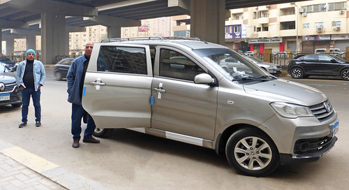
Besides that, I wanted to see the Mediterranean along the way which also ruled out an overnight trip that, for some reason, seems popular with Egyptian drivers. Roshdy procured a suitable driver and vehicle for the trip and we set out for the coast early on a Tuesday morning.
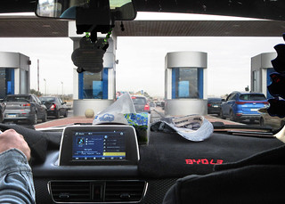
The forty-five years that Linda has been coming to Egypt has seen the Alexandria Desert road mature from a narrow and barely tolerable two-lane road into a modern tollway with five lanes in each direction. The last three lanes in each direction are still being paved toward the Alexandria end.
We headed out of town passing familiar landmarks and passing under the watchful eyes of President Sisi until we reached the toll booths at the start of the Alexandria Desert Road, heading northwest toward Alexandria and el Alamein.

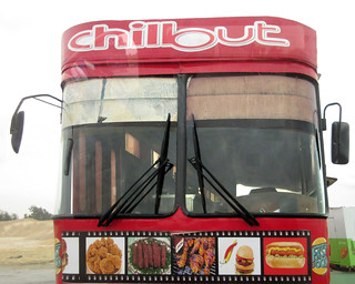
It is about 150 miles from our apartment to the north coast. At about the halfway point, near Sadat City, there is a rest area and the road splits with five lanes continuing northward toward Alexandria and another five lanes heading slightly more westward toward the beaches of El Alamein. We stopped for a brief break and coffee at the rest stop where Chillout operates a fast food truck.

The traffic was very light on the road to El Alamein although it it reportedly quite heavy on summer weekends with many of the citizens of Cairo anxious to escape the heat for the cooler breezes off the Mediterranean Sea.
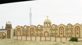
Just beyond Sadat City there is the large Monastery of St. Moses which has numerous reviews as a quiet place to visit. We have never stopped there but will add it to our list for future exploration.

Along the Mediterranean
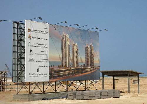
The north coast of Egypt between Alexandria and the Libyan border spans some three hundred miles of beautiful Mediterranean coast line. In particular, the stretch from Alexandria to el Alamein has a brilliant white sand beach sheltered from the waves by limestone reefs. In recent years, this area has become the focus of numerous real estate development projects. I pointed out the "megaproject" to build a New Alamein in this post back in 2018. Wikipedia now has an entry for New Alamein tracking progress. But, let's look for ourselves.
Back in 2018, there was just this billboard proclaiming the future of this high-rise complex.
Now we find this set of buildings nearing completion:
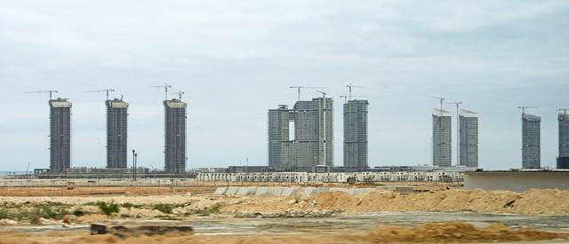
Are there enough people in Egypt with enough money to populate these seasonal homes with the cool breezes offering relief from the Cairo heat of summer? I have the business card from an Uber driver specializing in North Coast Real Estate if you are interested! Linda checked prices which mostly range from 200 to 300 thousand U.S. dollars and many are for sale before construction begins.
The supply of ten-lane freeway ran out abruptly just after we left el Alamein. The next 115 miles of road was largely under construction being widened to ten lanes from either four or two. It seemed like every mile presented a different configuration of interim roadway. It will really be nice someday.
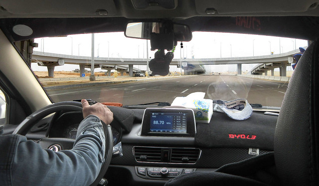


For those of us who were not driving, the view toward the sea was quite attractive.
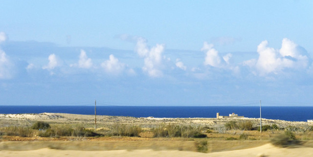
By the time we reached the Marsa Matruh welcome gate, we had not seen a gas station or rest stop in operation for several hours.

We pulled in at this modern looking facility seeking a restroom.

Travelers to Siwa are warned to be prepared for primitive rest stops. It would be prudent for travelers to Egypt to bring their own toilet paper and moist towelettes. The three doors to the W.C.s at this stop were sealed except for one labeled, "toilet." This style of fixture is known as a "squat toilet."
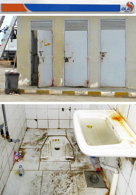
Ola Energy (Oil Libya) will not be getting many stars on their reviews.
Matruh to Siwa
We bypassed the actual town of Marsa Matruh (2018 visit described here) and reached the junction of Highway 40 with the Siwa Oasis - Marsa Matruh Highway where we turned inland to the southwest. It was just past 2:00 p.m. We were six hours into the trip with only three and a half to go. From this point, it is still 140 miles to the Libyan border town of el Salloum.
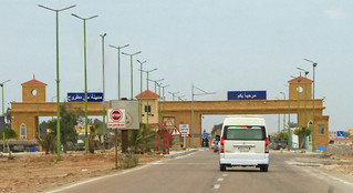
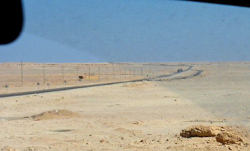
Here we met our first request for passports by the military. You won't see any pictures on the blog of the military as photographing any military facility or operation is strictly forbidden. You don't just lose your camera or photographs, you go to jail. Suffice it to say that we produced our passports four times between Highway 40 and the Siwa Oasis. We felt well-protected.
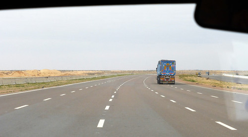
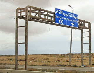
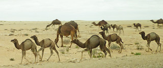
There is no prohibition on photographing camels or other desert flora and fauna. The area near the coast is reminiscent of the Idaho or Utah landscape but for the camels. The first fifty miles or so has vegetation of the sagebrush variety, gradually diminishing in density.

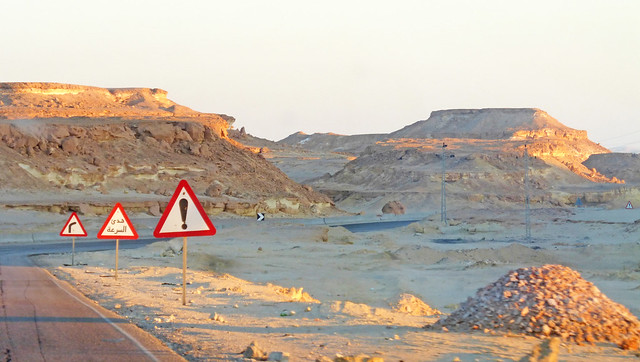
As we progressed inward, chalky limestone outcroppings dominated the scenery. This blacktop road dating from the 1980's ranges in condition from OK to poor. There is a replacement under construction alongside it - already paved in about a third of its length. This is going to make for a much smoother trip in the future.
Our driver, like most Egyptians, took advantage of the light traffic to use "the other side" of the highway at frequent intervals. Like most three hour highway drives, this one is broken up in the middle with a place to rest, have a beverage and buy snacks. Just past another military checkpoint, we came to this facility.
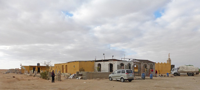
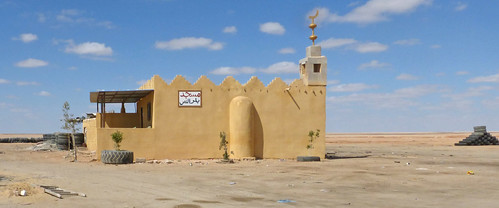
I looked on Google for this spot a few days ago and had a great deal of trouble finding it. Apparently it has changed hands, being known previously as "Mr. Amo's Caffeteria." There is a sign on the adjacent mosque that gives the name, more or less, as the "Mosque of the halfway well."
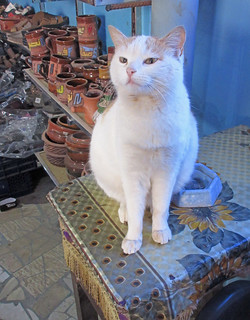
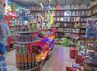
Besides snacks and beverages, this place has all the miscellany that you might expect of a general store in the middle of the desert. Boots, olives, a friendly cat ...
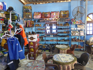
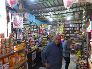
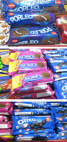
And plenty of snacks, that means nearly every kind of candy know to mankind. Oreo cookies and their imitators are popular items along with Twinkies and Hohos.
I was intrigued by the paved rode running off to the west with signs labeling it as SWM Camp.
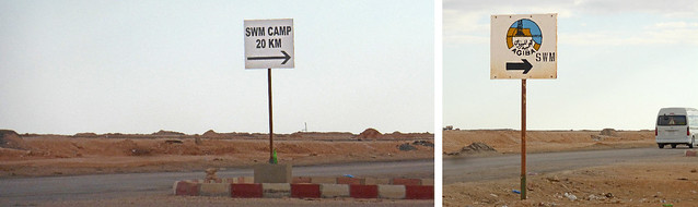
It was a bit difficult to find the meaning, but Google came through again. It turns out that there is a great deal of oil and natural gas lying below the surface of this desolate desert. SWM stands for the South West Meleiah Oil field where Agiba Oil is pumping a great deal of petroleum.
This article
from Egypt Today from five years ago explains:
CAIRO – 29 January 2018: “Agiba Petroleum Company is planning to produce 46,000 barrels of crude oil per day and 16 million barrels per year during the fiscal year 2018/2019,” Chairman of Agiba Petroleum Company Mohamed al Kafas said in the general assembly meeting of the company.
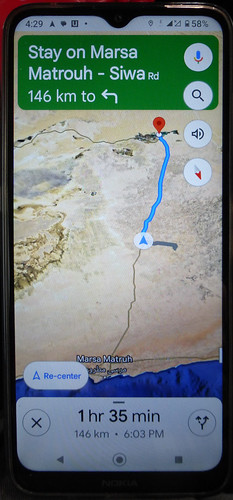
I have tried to find that road from Cairo on Google maps, but it only seems to show up when one is located nearby. It showed up as a broad line on my phone while we were at the halfway point. A curious feature of Google maps perhaps?
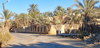
The second half of the road from Matrouh to Siwa took us over the edge of the hill/escarpment and brought the oasis and town of Siwa into view at sunset. We descended to below sea level and found our oasis in the desert.
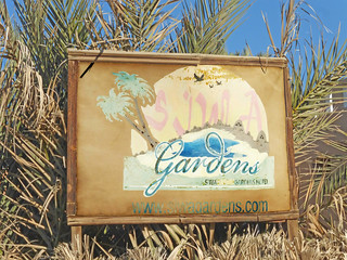
My GPS in the phone took us on a couple of turns through the town square and out a back road through the date palms about a quarter of a mile to our destination, Siwa Safari Gardens Hotel.
Including stops, the journey had taken just ten hours and 15 minutes. It felt like a pretty full day.
Needless to say, there are more photos available on Flickr in this album.


1 comment:
At last!!! The long awaited Siwa posts begin! Settling down for a good read.
Post a Comment